The Beauty Of The Earth’s Surface December 2009
NASA’s Shuttle Radar Topography Mission measured the earth’s surface elevation in February 2000 using radar interferometry. The resulting data is available to the public and can be used for various purposes. I have been playing with the data over the last days and experimented with different methods for visualizing terrains in 2d and 3d, primarily in the context of Openstreetmap rendering. However, nothing has impressed me more than this very first plain grayscale image I produced (showing the area around and to the north of Vienna).
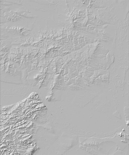
I have never seen so clearly the details and variation of the earth’s relief. On most maps, data like this is rendered in the background to give the viewer a sense of depth, but map graphics and surface textures are usually layered on top and take away a lot of the clarity that is so stunning here. One has to consider that the image shows an area that is usually considered to be rather “flat” - but look at how one can see the thousands and thousands of years of wind and rain working on the “Weinviertel” area to the north. Or look at the sharp edge of the “Wienerwald” area, suddenly dropping down to the really flat plains of the “Tullner Becken” and “Wiener Becken”.
I considered adding some labels and paths as means of orientation, but then I liked the idea to leave it like it is as a puzzle for you to figure out the locations of places you know in the image.